The Flexible Visitor Map
TouriMa is an interactive digital map of your place, featuring POIs and routes with texts, images, audio guides, step by step navigation and more.
Rich of features
This software comes with a wide range of features and can be customized further.
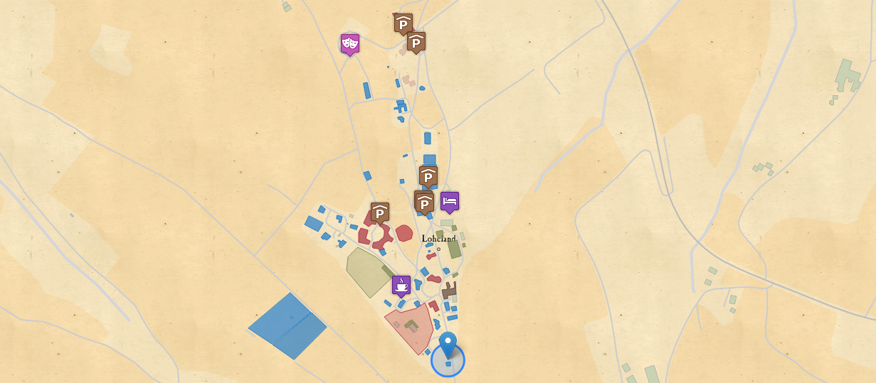
Interactive Map
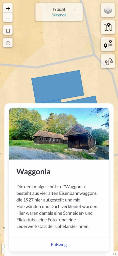
TouriMa is based on a simple standard map that can be enriched with clickable points, areas and routes, where pictures, texts and audio tracks can be added.
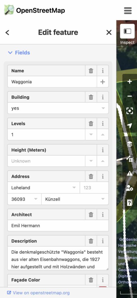
Map Data
Instead of just adding to this map, the TouriMa concept is based on enhancing the underlying OpenStreetMap data that is used by a range of other tools – e.g. many hiking and cycling applications – as well first.
Additional Information
The Application menu using the logo on the lower left offers a tab to answer common visit questions, and another tab for a short (or long) overview of the history of the place.

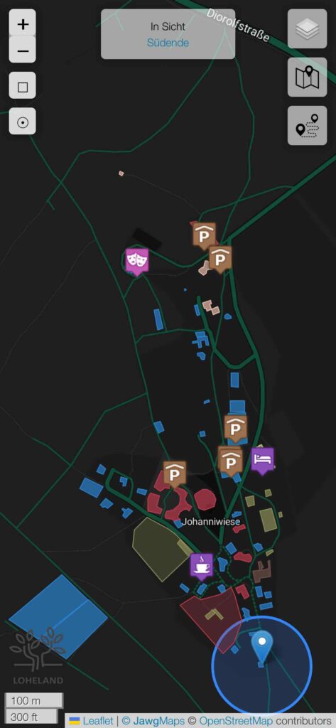
Map Design
Next to the standard design provided by OpenStreetMap, a wide range of custom map styles is possible. From the artistic watercolor to the nerdy Matrix style, chances are there’s something already existing, or we can up with a custom map.
Navigation
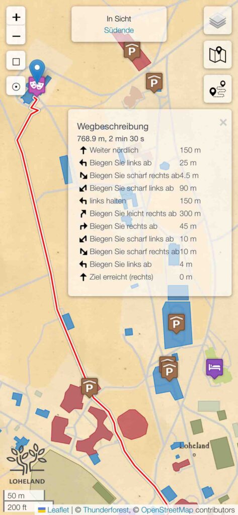
Chances are your place has grown historically. The best online map is only so useful if it wastes your time searching for the best way. TouriMa includes a walking navigation option from current to selected destination point, showing the path and instructions.
Gamification
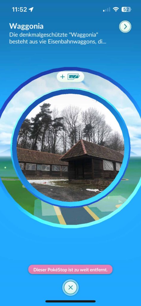
Some Augmented Reality games use the OpenStreetMap data as well. Even just the map improvement will therefore benefit these games. Beyond that, custom points of interest or routes can be added to games like Pokémon GO to bind players to your location.
Tracking
Optionally, you can track users of the map using Matomo (formerly Piwik), a more privacy friendly telemetry platform.
Sustainability
TouriMa is mostly self contained, including all necessary files, with very few exceptions (map images, which can be included, and routing services), for which alternatives exist.
Dark Mode
Dark Mode turns the screen darker to make it easier to read during night time.